Boston in Five Frames: Water, Streets and Neighborhood Life
A completed visual essay through Roxbury Crossing, the waterfront, the Charles River, Boston Common and Roslindale Village, using five credited archival photographs.
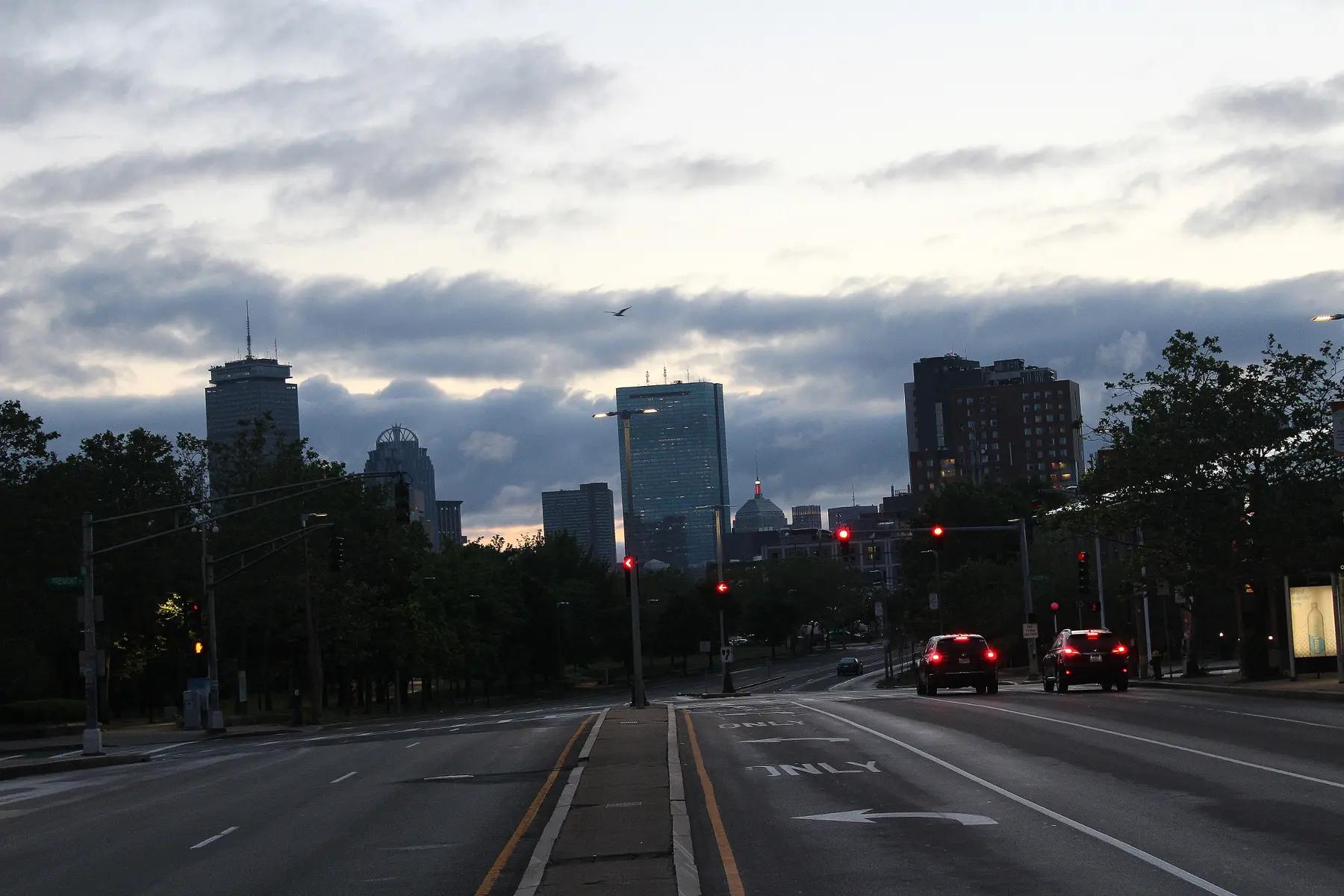
Roxbury Crossing · June 6, 2016 · 5:01 AM. An early-morning view toward downtown from Roxbury Crossing. Archival photograph; not a 617 News field assignment.Photo: Mohamed Hayibor / Wikimedia Commons · CC0Resized and converted to WebP by 617 News.
Boston looks different when the route is the subject. A road draws the eye toward the skyline; a shoreline turns a dense neighborhood into an edge; an ordinary intersection makes room for a park. These five archival photographs follow those changes in viewpoint, from a broad city outline to the details of a neighborhood street.
The photographs were made by different people between 2014 and 2024. They are presented as a curated visual essay, with new editorial text by 617 News. They do not record a single day or a new reporting trip.
01 / Roxbury Crossing: follow the road
In Mohamed Hayibor's opening photograph, lane markings and a narrow median pull the eye toward the towers. Red signals and two sets of rear lights punctuate the darker street. The skyline is familiar, but the foreground changes its role: this is a city approached through the road system, with distance still to travel. The source dates the frame to 5:01 a.m. on June 6, 2016.
02 / Waterfront: read the edge
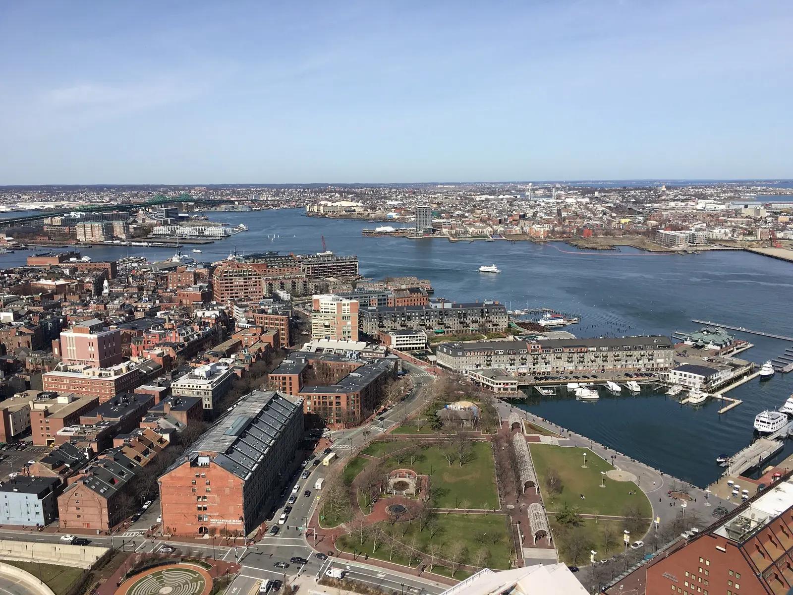
Judyg143's aerial view changes the scale. Christopher Columbus Waterfront Park opens a patch of space beside the close-set buildings, while the harbor forms a much larger open area beyond. Paths, roofs and the water's edge become parts of the same composition. From above, a park can look like a pause in the city; at ground level, that pause is a place to spend time.
03 / Charles River: let the foreground move
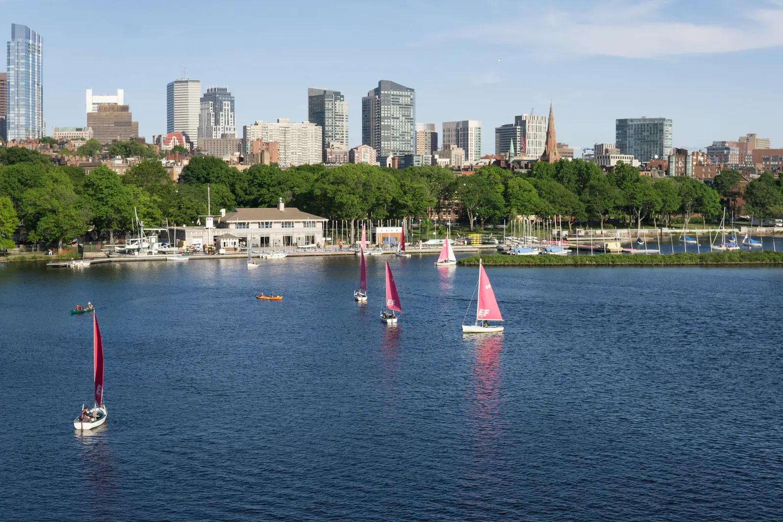
Trevor Mccourt places bright sails and small kayaks between the viewer and Back Bay. The buildings form a relatively steady band across the background; the scattered boats give the water its rhythm. The contrast is a reminder that a skyline photograph can also hold everyday activity. Look again at the empty water between the boats: it gives each small shape room to register.
04 / Boston Common: watch the light
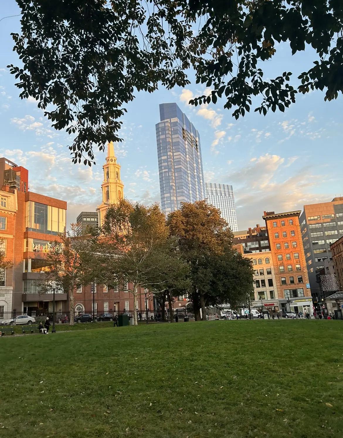
Warm light catches Park Street Church and the buildings beyond Boston Common in Drgage25's March 2024 frame. The picture brings older architectural forms and the surrounding skyline into one view. Its interest is in what the light selects: edges and surfaces become easier to notice when neighboring areas fall quieter.
05 / Roslindale Village: return to street level
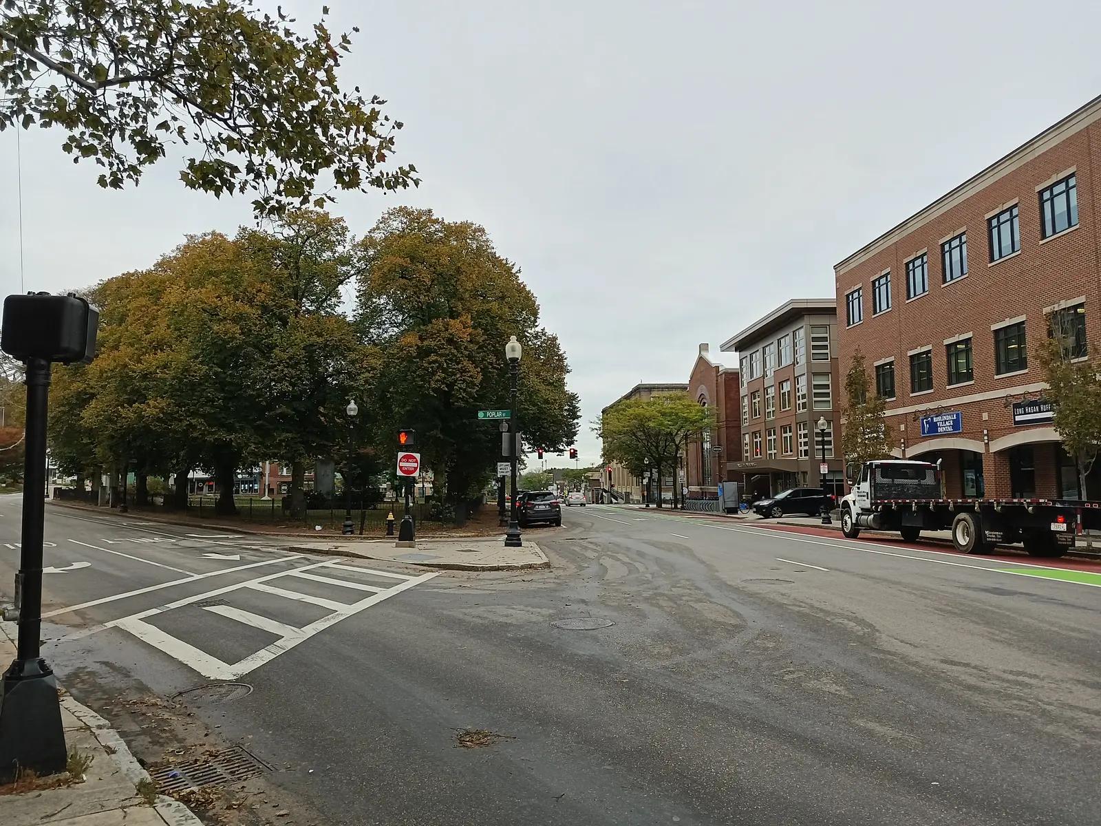
E. Mongeau's October 2021 photograph ends the sequence at an intersection. Crosswalks, a green bike lane, a truck and the trees of Adams Park share the frame. Unlike the aerial waterfront view, this picture gives the street back its competing directions and uses. The neighborhood does not need a spectacular sky to be worth attention; the arrangement of its ordinary parts is enough.
Keep looking on your own block
The sequence moves from skyline to intersection, but there is no single correct scale for seeing Boston. Start with the view you recognize, then notice what sits in front of it. Explore more stories from Roxbury, the Waterfront and Roslindale, or send a visual-story idea from a place you know well.